MILWAUKEE - The newest snowstorm has begun in Southeastern Wisconsin, and 24 hours after the first batch of snow fell, around a foot of snow is expected around nearly every part of Southeastern Wisconsin.
"It's right on track in terms of timing and it still looks like it's going to bring as much snow as it did (Monday)," said Storm Team 4Caster Craig Koplien.
"That is around a foot, putting the range between 10" and 14" throughout all of Southeastern Wisconsin. The bullseye is right over not only Milwaukee, but all the surrounding counties, too. 10"-14" by the time this is done by around 3:00 a.m. tomorrow morning."
That prediction has brought about a Winter Storm Warning for all of Southeastern Wisconsin until 6:00 a.m. Wednesday.
Is there a break? Do we know of a time that we can sneak out and grab that loaf of bread or carton of milk?
Somewhat, but not really, according to Craig. "Ebbs and flows are probably good way to put it. It's not going to fall at a completely steady rate all day long. That said, there's really no point in time where it's going to get really, really, and then back off at some point to almost nothing. It's probably going to be a steady snow all day long. If anything, the heaviest snow fall will probably not come until this afternoon and this evening, but even that's splitting hairs just a little bit. For the most part, we're talking about a steady snow all day until around or a little past midnight tonight."
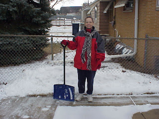
I'm not worried. Grandpa bought me this brand new shovel yesterday at Walmart so I'm set to take on what's coming (gulp!). I will keep you posted as to how my new shovel stands up to its approaching challenge. I do have a plan of attack.....do not wait till the end......get out there and shovel throughout the day. However, I better find my boots and hat first!! Till later (-:

No comments:
Post a Comment